June 24, 2008

The Ten Best Free Things to do on the Outer Banks

  • NCSA Cabaret Performance

Today is the opening performance of the North Carolina School of the Arts (NCSA) Summer Performance Festival at Festival Park. This is a great series and it is free. Tonight the NCSA presents the American Music Ensemble in a "Ragtime Revue". The entire series is highly recommended. The entire schedule is available at the Festival Park web site. Bring a lawn chair or blanket, a cooler and hear some great music. It runs through Friday with a different performance each week for the next 6 weeks.
There are many other free things to do on the Outer Banks so here is my list of the 10 best free things to do around here. In this case free is defined as not costing anything except the price of getting to the site. No fee, nothing to buy, just show up and enjoy:
  • See Some Art
There are a lot of great galleries around the area. You can walk in and visit for free. I recommend the Seaside Art Gallery on the beach road in Nags Head or Glen Eure's Ghost Fleet Gallery in Driftwood street. This area is known as Gallery Row and you can park and visit 7 or 8 galleries on foot. (between the highways just north of Kelly's).
In Duck check out the Greenleaf Gallery run by Didi Tupper and her artist husband Rick. Great place to see local and regional artists.
Downtown Manteo has a number of great galleries including the Dare County Arts Council gallery and the Gallery at Festival park which hosts rotating shows.
Finally don't miss the art collection at Nags Head Town Hall. It hosts probably the best collection of local art and artists in Dare County, maybe anywhere. Just walk in and walk around. All the art is on public display and there is a directory to help you find or identify particular pieces. It is an absolute treasure.
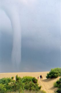
Climb the giant dune this blog is named after, trek a nature trail or learn about the area in the museum, this site can fill and hour or a couple of days. Bring the kids and let them run up and down the hill a few times. You will appreciate it at nap time.
Tip: Do not go mid day in the summer time. Go early or late. The sand can be over 120 degrees at noon in July. About an hour before sunset is a great time. The park rangers give a program about a half hour before the park closes that explains how the hill was formed and its role in the local ecology. You can even go to the beach on the west side of the park. There is a great sound access point with a nice beach. Bring water shoes or sandals because shifting sands can reveal broken glass and other debris. A great place to go when the ocean is too rough.
Turn west at McDonalds in Kill Devil Hills, drive about a mile and enter another world. Nags Head Woods Preserve is operated by The Nature Conservancy and owned variously by TNC and the Towns of Nags Head and Kill Devil Hills. The maritime forest is a vestige of the barrier island ecosystem that has been preserved intact. Large live oak, sweet gum and pine trees border fresh water ponds. Lots of birds and wildlife including our local deer herd. There is a great set of trails to walk. Wonderful in the hot summertime or a windy wintertime day.
If walking in the summer time think tick protection - long sleeves and pants, light colors and check yourself after walking. Even with that caveat this is still a great site (sight) to see.
  • Walk and view the Historic Nags Head Cottages
Park at St. Andrews Church on the beach road in Nags Head and walk north and south to see the original beach cottages. Many of these date from the late 19th century or very early 20th century. Make sure you see the Buchanon Cottage across from Mulligans. It is the largest and it hosted FDR when he visited the Lost Colongy during WW II.
Another great way to see these homes is to park at Dowitcher St. and walk over to the beach through the Small St. access. Head north up the beach and get a sense of what life was like a long time ago. the beach is uncrowded and the views are spectacular. Do it at dawn and bring your camera.
There are several good books on the cottages but you don't need one to appreciate their beauty. Nice brief Nags Head history at the OBX Guide or try this Google search page for more information about the area.
OK This one is easy. No matter where you are there is a light house within driving distance in fact there are lots of them. Corrolla, Bodie Island and Hatteras all have interpretive displays and great visuals. Both Hatteras and Bodie Island have nature trails. The walk or bike ride around the Ocracoke Lighthouse is fascinating. Stop by the Ocracoke Preservation Assoc. Museum for a great hour or 2 learning about life on Ocracoke in the auld toimes
To get to the Ocracoke Lighthouse you need to do another great free activity, ride the Hatteras-Ocracoke Ferry. The 45 minute ride is as scenic as it is refreshing. You will feel your cares drift away as you get closer to Ocracoke. The boat ride is worth drive down by itself. Go across, see the lighthouse and the ponies, have picnic lunch and ride the ferry back. All for the cost of your gas. This is my favorite day trip.
We opened this post talking about the free summer performances at Festival Park but there is a lot more free stuff there. Check the schedule for kids programs, movies and exhibits in the gallery. You can pay to go see the Elizabeth II but you don't need to to enjoy this great state run attraction. We saw a traveling Chinese acrobatic troupe in May and the NC Symphony the next week. There is always something going on.
The restored lifesaving station in Rodanthe (formerly called Chicamicomico) is a great place to stop on Hatteras Island. The museum displays photos and artifacts from the days when the Lifesaving Service resuced hundreds of sailors and passengers from the dangerous winds and currents around Cape Hatteras. One example
On August 16, 1918, the British tanker Mirlo was sunk by the German submarine U-117. The rescue of 42 of 51 British sailors is considered one of the greatest rescues of WWI and the early Coast Guard. This amazing, heroic rescue is told in other papers.
Drive down from Nags Head and stop on your way to the Hatteras Light or have lunch at the Pea Island Wildlife Center interpretive area, along the way.
NOTE: The Chicamicomico Life Saving Station now has an admission fee so it is not free. The FWS Wildlife Center is free so I still have 10 things. See the comments section for details.
At the other end of the Outer Banks the NC Wildlife Commission has established a marvelous education center in Corrolla. Like Jockeys Ridge, it is free with some small fees for special programs. Lots to see and do while you learn about the natural history of the area and the heritage of the people who settled the area and harvested its bounty.
  • Go to the Beach
The last one is also the easiest one. The best free thing to do on the Outer Banks is just to go to the beach. Sit, read, walk, swim or fish there are at least 10 ways to enjoy the beach and in NC (unlike many places) it won't cost a dime to go to park. The Visitors Bureau has a pretty good list of beach access sites complete with the status of lifeguards and handicapped access. Pick one and have a great time.

There is my list of the top ten free things to do on the Outer Banks. It could easily fill a weeks vacation or even 2 weeks depending on how much time you spend on the beach. Let me know the free things you enjoy. I reckon the only one I didn't mention is reading this blog.
Ciao


Labels: , , , , , , , , , , ,

June 2, 2008

Starnews - Public access, residential peace?


We have been hearing a lot about access. The ORV issue at Cape Hatteras is basically an access issue. I poke Southern Shores frequently about their lack of access. Acess battles rage up and down the coast. How can the public access the beach and how does that impact the neighbors is being debated up and down the coast.
The Wilmington Star News had an insightful editorial about the problems that accompany access entitled Public access, residential peace? The piece talks about the struggle over a public boat ramp and marina in Topsail Beach. It goes on to identify a series of controversial beach access projects on the southern NC Coast. It closes with this paragraph that contains a nugget we all need to remember:
"As other coastal communities wrestle with the omnipresent issue of public access, they should keep in mind, as Topsail's board did in this case, that the beach belongs to everyone - the well-heeled and those who favor flip-flops."

Ciao

Labels: , , , , , , , ,

February 27, 2008

ORV meeting Tues 2/26


I decided to look in on the NPS negotiated rulemaking committee's meeting at the Ramada Plaza in KDH Tues. morning. It was fascinating. There was almost no substantive discussion in the first 3 hours. It probably started shortly after I left and even then I don't expect it was very substantive or the substance was important.
The most important news was that the National Park Service (NPS) rejected an offer from the Outer Banks Visitors Bureau to give the NPS money to support an economic impact analysis of ORV activities in the Cape Hatteras National Seashore (CHNS).
A little history. At the first meeting of the committee, the NPS and its consultant said they didn't have enought money to do a complete economic analysis. The OBVB stepped up and offered to help (I believe the offer was $20,000 but I'm not sure). NPS was considering this offer. A subcommittee formed to oversee the analysis had a teleconference. Environmental interestes attacked the offer as an effort to extort NPS. Words, harsh words were exchanged. Things cooled off, everyone apologized. Then the NPS decides not to accept the money, saying basically if it causes that big a problem we won't take it.
Why is this important? First off the committee needs the best data possible. The more money they have the better the analysis will be. If the analysis is incomplete or insufficiently broad it may be open to challenge, first by outside experts then in the courts. If it is not top notch it can't be relied on. Superintendent Murray assured the group that NPS would find the resources to do a proper analysis.
There is a more troubling aspect to this episode. Basically the environmental groups created a phony issue. There were no strings to the OBVB money it was a gift. The analysis would have been done by the same people with the same broad oversight by the committee. No chance of conflict of interest. By raising the false issue the environmental groups get a less effective analysis opposinging their interests. Really dirty pool and then to start the name calling just makes it stink.
My questions for Mike Murray:
  • Will NPS only use environmental data and analysis developed with NPS dollars. No citing outside reports, no use of existing bird counts done by other groups?
If we need independence in economic analysis then we need the same rules in environmental aanlaysis. Sounds fair to me. Don't expect that this will happen.

Enough for now. Some of you have short attention spans (grin) so I will add more in another post.

Labels: , , , , , , , , , , , ,

June 3, 2007

A challenge to Mr. Baker, who is a journalist.

The Code of Conduct has been suspended for this post.*
Stop the presses. I just found out that a major hurricane might hit the Outer Banks and if it did it might do a lot of damage. Mike Baker has penned the kind of piece that gives the press a bad name. If this is journalism, I'm glad that I'm a politician. It is inflammatory and it is inaccurate.
The basic premise seems to be that Prof. Stan Riggs thinks that a Katrina size and intensity storm striking the OBX at just the right angle would open up several new inlets and wipe out a all of the development that has occurred in the area over the last century. Riggs theory may be a geologic possibility but it seems far fetched to me. Yes, a major storm coming up the sound would push a lot of water north then back south and east as the storm passed. This is what opens up inlets (really outlets). At the point of landfall the storm surge would be devastating. If Katrina is a gauge this area could cover 20-30 miles of oceanfront and extend inland for many miles. Here we hit a small problem. A storm following that track doesn't push storm surge across the entire OBX and a storm coming in due east (rare but possible) would push up lots of surge but again how wide is the swath. Soundside flooding doesn't destroy building on a widespread basis. Somebody needs to show me the model of this storm that pushes up a 20+ foot storm surge across all of Hatteras Island, across Oregon Inlet and up to Corolla. This is what I get from terms like 75 percent of these islands could be gone,"It just isn't how storms happen. Come on Stan you can do better than this.
Mr. Baker says that "Dozens of hurricanes" have hit the OBX in the last 400 years. Really?? Dozens, how many dozens pray tell, maybe a gross or more. Yet the islands are still here? Yes, Isabel reopened an inlet and we are overdue for another one to open up due to conditions at Oregon Inlet but multiple inlets from Corolla to Portsmouth Island, is that really what Dr. Riggs is predicting? I sincerely doubt it.
Next quote:North Carolina's Division of Emergency Management estimates that, even if a Category 5 hurricane turns toward the Outer Banks, several hundred defiant homeowners will try to ride the storm
Yes, there are idiots who would stay behind, even in the face of a Katrina like storm approaching the coast. This number gets smaller every year and with a storm like the one Riggs needs to fulfill his geologic predictions the death and destruction is just as likely to take place inland as on the coast. Isabel did major damage across eastern NC. H. Floyd tore up southern and central NC. Its not just coastal residents that are at risk. I guarantee there wouldn't be many of the 300,000 people who are in the area on any given summer weekend around. They would have been sent home in an orderly manner a long time before the storm hit. Sorry, I guess this point doesn't seem to advance Mr. Baker's alarmist agenda. I'm not even sure you would find 100 people in Dare County in the face of a Katrina type Cat 5 storm. You wouldn't find many people from local governments. Most of them would have followed the tourists inland. Even the rescuers get out of the way of storms like that.
So what happens when this monster storm hits. and what does it destroy, what are its impacts? Who better to ask than Dr. Orin Pilkey? Almost anyone actually! Lets see what Brother Pilkey has to say from his perch in Durham and remember as one friend reminds me emeritus means he's unemployed.
And the islands won't simply disappear. While much of the Outer Banks are untouched by man, protected as part of two national seashores and a national wildlife refuge, there is rampant development elsewhere. A storm that wipes out the islands could dump an untold amount of gas, chemicals and remnants of destroyed homes and buildings into the ocean.

"The environment is the sort of the unnoticed victim that barrier islands face in hurricanes," Pilkey said.

OK, I admit that the term "rampant development" caught my eye. This coming from a TV station in Wake County where they build more houses in a week than we build in Dare County in a year. Where storms, hurricanes and winter storm have done more damage to more homes and dislocated more people in the last 20 years than has occurred in Dare in 40! Go look it up Mr. Baker. You want to slow storm damage stop building homes in Raleigh. Look at photos from the storms of the 90's. See damage in Dare NO! see damage in Durham Oh!! You are a lying sack of ... but I digress.
Ok so we have a lot of homes on the OBX that weren't here 40 years ago, Dr. Pilkey what happens when they get destroyed? They pollute the ocean! are you serious?. I will stipulate that there will be household cleaners and bleach released in damage of a major storm Some septic tanks will uncovered and their contents exposed, if you stipulate that a much larger (much is not the right order of magnitude make that a Super Enormous More) pollution problem is posed by inland flooding both the surge in storm water caused by the destruction of natural water sheds in Wake and Johnston Counties and pollution from the flooding of agriculture and industrial development that simply doesn't exist on our rampantly developed Outer Banks. Discharges from overloaded centralized sewer plants casuse more pollution in everyday operation than would be released in a storm on the OBX. Environmental damage from a hurricane OK maybe if I think New Orleans style flooding, flooding that wouldn't have occurred if the Federal government had done the job of flood damage prevention right in the first place. Just like the damage that would be prevented by a flood damage project in Dare County. Orin Pilkey is worried about some Clorox in the ocean? I don't think so. He is worried about his agenda to get publicity and promote his books. If he is so concerned about pollution then why doesn't he support flood damage prevention projects that would prevent the environmental damage? This stuff is laughable if it weren't so dangersous. Next quote:
"Riggs estimates that some 1,250 acres of shoreline and wetlands erodes into the ocean each year."
Wetlands erode into the ocean? Where? There are no wetlands that have eroded directly into the ocean. Maybe via the sound? OK but that number is really big. That represents an area the size of Nags Head Woods every year. What is the scope of Dr. Riggs projection? Is it the world or the OBX? I don't believe it is the OBX. You wouldn't need the megastorm, this rate of erosion would destroy the area inside of a century. Next quote:
Officials have spent millions trying to salvage homes with stilts and sandbags, and even by moving sand on their own. The costs can be staggering: a 50-year beach nourishment project to protect just 14 miles of beach in Nags Head and Kitty Hawk would cost $1.6 billion, according to an U.S. Army Corps of Engineers estimate.

"These are just stopgap attempts," said Jan Deblieu, the Cape Hatteras Coastkeeper for the North Carolina Coastal Federation, a conservation group. "We won't ever get the equation exactly right."
What planet are you on? Officials haven't spent millions on stilts or sandbags. They have barely spent thousands and that was on sandbags to protect roads. Virtually all sandbags are paid for privately exactly because the Federal government won't honor its commitment to flood damage prevention. Stilts, did you say stilts. Mr. Baker you are either an idiot or intentionally misleading your readers. There is no other explanation. Homes on the coast are elevated to prevent flooding. I thought flooding was bad. I thought damage was bad where did I get that? The homes are elevated because local zoning rules require it. The local rules are required to keep the communities in the Federal Flood Insurance program. A program that limits the amount of public money needed to clean up after a storm. A storm that hit an unprotected coast because officials didn't spend millions to protect it. You disingenuous bastard. Make up your mind. Do you want destruction or prevention. Do you want the government to pay or private property owners. Stilts.... yeah now there's a really bad thing.
OK, its time we meet the third member of the holy trinity of the High Church of the Anti-Coast, Jan Deblieu. Riggs, Pilkey and Deblieu, now there is balanced set of views for you. Read OBR on the coastal federation. (I had planned some additional comments on his topic but there is not time.) 1.5 billion over 50 years is a stop gap plan? Try again. Try calling Spencer Rogers of NC Sea Grant and talking about coastal development and building standards, hell just ask Dr. Riggs his views on beach nourishment (he understands its costs and benefits, just Google it you'll see). Jan, if you have your way we won't ever get to try to get it right, whatever it is. If it is preventing the kind of devastation the article leads off with or more realistically limiting damage from the more probable smaller storms that will hit the OBX, then Jan Deblieu and the CF would rather have damage than protection. We won't get it right because they don't think we should even live here.
Next quote:
Even a minor hurricane would be devastating to some parts of the Outer Banks. In Nags Head, for example, the homes that once sat comfortably on the beach now sit in the foaming seas several times each year.

Neil Carignan, an independent contractor, said a Thanksgiving nor'easter destroyed the septic drain field, water line, electricity and driveway of a client whose property is now condemned. Though the home has sandbags piled underneath its stilts, Carnigan pointed 100 feet behind the home to a plowed mound of sand.

"The waves were coming all the way up here across the street," Carnigan said. "The people across the street are about to have beachfront property because this home will probably fall in the ocean in the next Category 3 hurricane."

Damn, a storm caused damage in south Nags Head, now that is news. The ocean was up around the house, really? Wow impressive. Mr. Carigan is a builder and developer i assume. I guess Mr. Baker wants us to think that most builders abhor ocean front development or that some how coastal building isn't the most heavily regulated type of residential construction in the state or that somehow one house, probably built over 30 years ago, that has now been impacted by erosion is a unique or symbolic icon. It ain't. Erosion happens, and long term, slow erosion, often driven by nor'easters, is a much larger cause for concern than your projected monster storm. It is also addressed by lots of state and local rules. It doesn't represent the impact of "rampant development" but the visible sign of the lessons we are learning about living on the OBX.
OK I'm getting tired of this and you are too, so lets end it here. Simple challenge, Mr. Baker if you want to write a piece about the impact of storms on the OBX email me. I will be happy to help you learn about the issue and present both the very real threat and the very real responses that responsible people are taking everyday here on the coast. Then we can go work on your piece about the threats that storms pose to the rest of the state and what they are doing to prevent environmental and property damage, except that article will be much shorter because that's where people don't see the risks and aren't acting responsibly to protect against high probability events like a H. Floyd or Fran or Bertha or Isabel. That's were the our state's real storm scandal is about to occur. But what do I know. I'm not a journalist. Thank Heavens for small favors.


*Mr. Mayor
Yes, Mr. Muller
I move to suspend the rules for the duration of this post
Is there a second.
Second
Moved and seconded by Mr. Muller to suspend the Code of Conduct for the duration of this post all in favor indicate by saying Aye.
Aye.
Motion carries 1-0

A motion to suspend the rules is a procedural motion used set aside the agreed upon rules of procedure for legislative bodies. This is what Senate Republicans threatened to do to get Bush's conservative judges rammed through, but that is a different post.
In this case I am using it to set aside the Code of Conduct I have adopted for this blog because I need to be free to tell Mr. Baker what an idiot he is in plain language.

Labels: , , , ,

June 1, 2007

Va. Pilot: No Turning Back on Norfolk Beaches - Science - RedOrbit

I guess I'm feeling a little nostalgic this morning. I plan to go over to the Board of Elections this afternoon and submit the paperwork to close protectnagshead.org, the referendum committee Bob Oakes and I formed to work towards passage of the Nags Head beach nourishment bond. I was in that kind of reflective mood when this editorial from the Va. Pilot popped up in my Google News alerts. The Pilot was pointing out that Norfolk's East Beach was recently recognized by the American Shore and Beach Association as one of this year's outstanding nourished beaches in the country. The piece relates the brief history of beach maintenance in Norfolk following wide spread flooding and erosion caused by Hurricane Isabel the goes on to talk about the impact of the projects.
"The replenishment served as the backdrop for East Beach, the village that lit the fuse for the Ocean View gold rush. The millions of dollars spent from East Ocean View to Willoughby Spit to save the beaches has been multiplied a hundred fold.

The winds and tides from the 2003 storm devoured half of the seven miles of Chesapeake Bay shoreline, breached homes in Willoughby and destroyed practically every plank walkway from the street to the water. Fixing them cost about $9 million, more than Norfolk had expended on beach maintenance in the previous 20 years of benign indifference.

Intent on applying that lesson, the city has followed up by creating a robust erosion-fighting plan backed by an annual $2 million appropriation through 2012. That's a prudent acknowledgment that too much wealth is now at risk to engage in wishful thinking about Congress putting up money for Ocean View sand piles.

That's the good news. The downside is that there's no turning back; once public beach nourishment begins, it's impossible to stop. That should spur debate over who should pay for the beach and whether the public gets enough access to it."

The Pilot goes on to suggest that Norfolk voters might not be fond of continuing this spending plan for the remaining miles of Norfolk's Chesapeake Bay coastline, suggesting that voters in Va. might follow our local lead and reject plans to spend tax money on beaches no matter how successful the projects are. Interestingly, the issue doesn't seem to be dollars per se but access. Norfolk has reduced the already limited access to the nourished beaches and this has drawn outcries from the beach access advocates. The article closes by suggesting the the Norfolk Council is on the right track, searching for more ways to open up the beaches to residents and visitors and I can only agree. The public should have access to beaches they are helping to restore, it is very important element in any beach restoration project.
Interestingly this issue never surfaced in our Nags Head debates. In large part that is due to the excellent access program the Town has implemented over the last 30 years. You no longer need to park in the sand to go to the beach in Nags Head.
Perhaps its time to follow Norfolk's lead and bring access back up as an issue. Our local beaches generate an enormous amount of money for local governments, yet like Norfolk, some parts of "our" beaches aren't equally accessible to everyone. In particular, the beaches in Southern Shores have no public access. The very same town that protested so much when it share of the the beach generated revenue was threatened. Nags Head, Kill Devil Hills and Kitty Hawk offer an enormous amount of public access to the oceanfront. This has been done with public money and without any restrictions. Duck has limited public access but not much.
Its time we start tying access to tourist generated money to providing at least some public beach access. If you don't provide access you don't get the money. I'll bet there are some great undiscovered surf breaks in "The Town That Won't let Me go to the Beach" (TTTWlMGttB). Sammy the surf dog probably doesn't even know about them because he can't get to the beach even if he was allowed on the beach (TTTWlMGttB doesn't allow dogs on the beach from May through Sept. but that's a different issue). Sorry Sammy, maybe that nice lady at Brew-Thru will give an extra treat instead. Bill might find some new spots to windsurf and Monticello might be able to suggest a new brew to go with the uptown beach scenery of TTTWlMGttB. We all would benefit from access to all our beaches. Lets hope we get some soon. If we start tying money from beaches together with access to beaches we'll see a lot more.
Well, its time to close this piece, I want to go over and sit in the sand before I trek to Manteo. The ocean was gorgeous yesterday over at Loggerhead access. It should be just as nice today. Maybe I'll try a new spot, someplace different, just so long as its not in Southern Shores, the town where YOU can't go to the beach either.

Labels: , , , ,

December 13, 2006

Poulos Christmas LIghts 2006

From A few daytime photos from the Poulos display


I have noticed a lot of search activity around the Poulos family's remarkable Christmas display. The display won the Today Show's Christmas decoration contest last year as best in the country and this year it continues in the same tradition. I have included a link to several pictures taken during the day last week at the house. However this does not do it justice. You need to see it at night for the full effect. I may try to get by later this week and get some night shots to post.

If you want to find the house:
Heading South on Rt. 158 into Kill Devil Hills
1. Proceed to light at Ocean Acres Dr.
2. Turn right at Ocean Acres Dr. (opposite MacDonalds)
3. Follow Ocean Acres Dr. The road will shift from paved to gravel as you go up a hill. Just over the top of the hill you will find the Poulos home.

On busy nights it may be best to park on Ocean Acres Dr. on walk up to the house since it gets very busy and there is no parking.

You can find a basic Yahoo map centered on the home here

Labels: , , , ,